
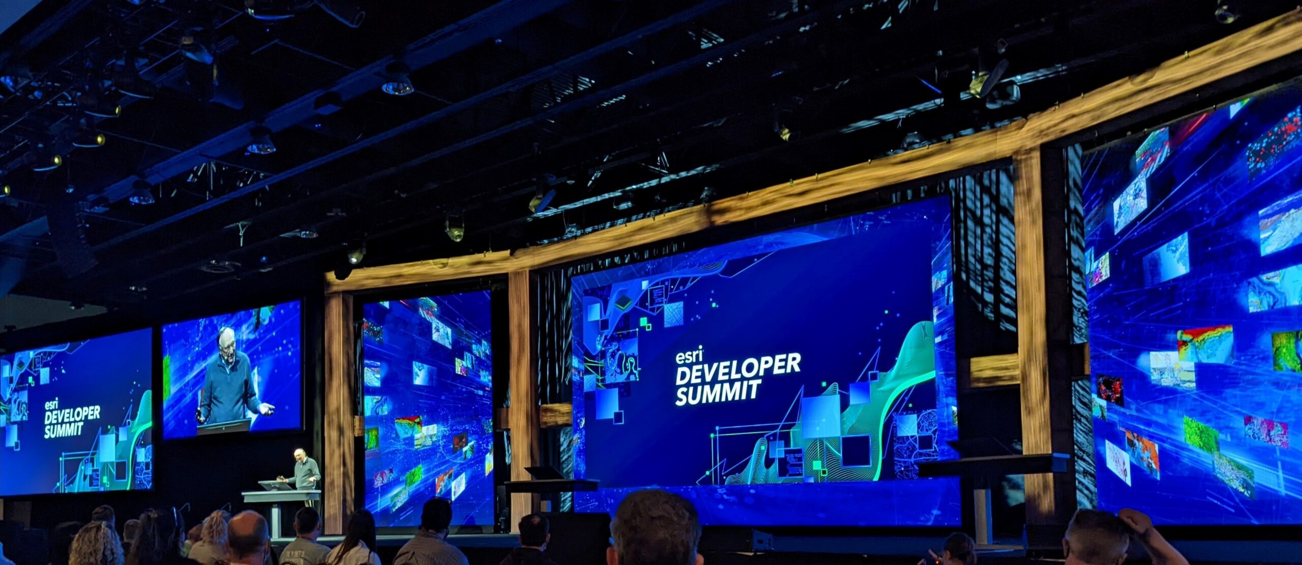
The DVG team was in Palm Springs last week for the Esri Partner Conference (EPC) and Esri Developer Summit (DevSummit). There were announcements and presentations showcasing the new and improved products in Esri’s ArcGIS suite. The DVG team had the opportunity to meet with in-person (for the first time in 3 years!) and gain insight from the folks at Esri who develop and steer the products that are integral to the GIS solutions we create. There are a number of takeaways we want to share from our time in Palm Springs.
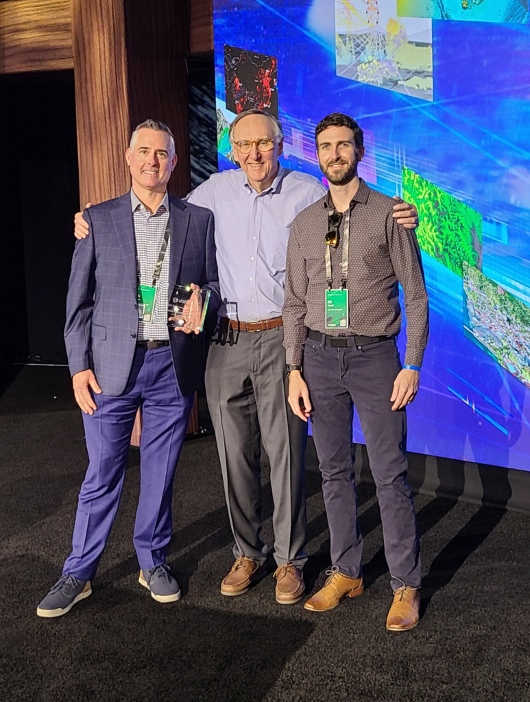
Esri Web Transformation Award
The first bit of news is that DVG received a Web GIS Transformation Award at Esri Partner Conference. This award recognizes DVG for evolving customers and solutions to the Web GIS pattern with SaaS. DVG is an Esri Silver Partner and has been a part of the Esri Business Partner program since 2012. We are proud of the Web GIS solutions we develop for our customers and are excited to share this news.

Esri’s Product Announcements
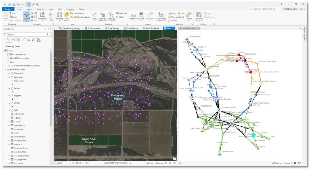
ArcGIS Knowledge
Esri announced their new product ArcGIS Knowledge, a enterprise knowledge graph software. ArcGIS Knowledge connects ArcGIS Pro to the enterprise graph store, enabling users to explore and analyze spatial, nonspatial, unstructured, and structured data. A knowledge graph organizes data from multiple sources into a network of real-world entities, relationships, and events; one such example is a supply chain. Now, using ArcGIS Knowledge, you create, edit, interrogate, and analyze knowledge graphs right in ArcGIS Pro.
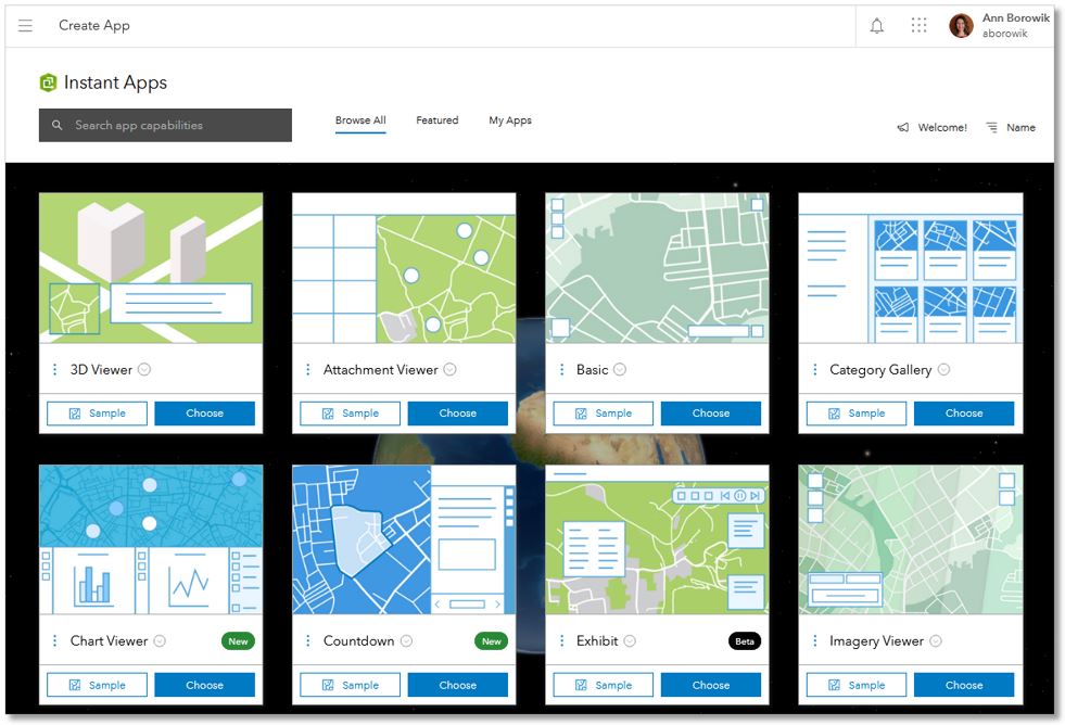
ArcGIS Instant Apps
DevSummit 2022 showcased the arrival of ArcGIS Instant Apps, a newer app in the ArcGIS App Builder suite. Instant Apps allows the user to quickly transform a web map into an app choosing from the library of app templates, which can be searched by desired app capabilities. The guided setup makes it easy and quick to configure your new web map so it’s up and available to your audience within minutes. There is also an option for express setup, which makes the process even quicker. Launch ArcGIS Instant Apps directly from an existing ArcGIS Online web map in the Map Viewer, the map Item Details map, or the app creation options on the AGO Content page.
ArcGIS Field Maps
Released in November 2020, ArcGISField Maps is becoming Esri’s primary all-in-one mobile application offering. ArcGIS Workforce and ArcGIS Navigator will be retired and their mobile funcationality will be incorporated into Field Maps, similar to how Collector, Tracker, and Explorer were deprecated and replaced by Field Maps last year. As such, Esri continues to make significant developments to Field Maps. In fact, there were so many enhancements announced and discussed at DevSummit, here is a quick list of the ones I caught:
- Expanded use of Arcade in Field Map for advanced formatting such as form calculations, conditional visibility, required fields and constraints in smart forms,
- Automating workflows using third-party technology Integromat (rebranded as MAKE) and Power Apps
- Peer-to-peer sharing
- Support for indoor positioning and floor-aware data collection
- View attachments in pop-ups
- Support for app linking
- Support for LRS
- Companion app through Apple Watch for using Tracking functionality in Field Maps
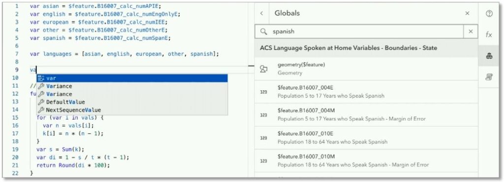
ArcGIS Arcade
The ability to use Arcade across the ArcGIS platform is expanding, with the number of Arcade Profiles growing and more functions added to each profile, proving that this expression language is an essential tool. Arcade can now be used within smart forms in Field Maps and for summarizing clustered features in web maps. Also, a new Arcade editor is coming in July 2022 that is being built using Monaco, so it will look familiar to coders who use Visual Basic. It will include some enhanced capabilities such as IntelliSense features, like code complete, and the ability to filter through layers, fields, functions, etc., just by typing, and most importantly, improved debugging with better error messaging. The new Arcade editor
ArcGIS Velocity
ArcGIS Velocity, the SaaS version of GeoEvent Server, for visualizing and analyzing big data and real-time data feeds, has a number of noteworthy updates. The new gRPC feed type, which is currently in beta, allows ingestion of real-time data providers not supported out-of-the-box with Velocity, opening up new possibilities. Enhancements were made to provide more information about a Velocity subscription, including improved storage metrics, logging, and storage capacity notifications. And Velocity now supports dynamic geofencing, allowing analysis based on two real-time feeds. For example, you can now configure an alert when a vehicle is approaching traffic, comparing both the real-time vehicle location and traffic feeds. That’s some powerful analytics available and fully integrated in the ArcGIS platform.

Other announcements
Here’s a rundown of some other announcements made at the Esri DevSummit 2022:
- The new AnimatedFlowRenderer (in beta) in ArcGIS API for JavaScript visualizes flow direction and magnitude information for meteorology and oceanography raster data. Seeing this impressive new visualization on the large screen at the DevSummit brought big applause.
- ArcGIS Pro 3.0 was introduced, which was built on Microsoft .NET 6 and will support Visual Studio 2022. This upgrade will make ArcGIS Pro significantly faster with noticeable time savings when performing analyses.
- ArcGIS Dashboards Classic is to be retired to make way for a new, faster Dashboards app built on version 4.x of the ArcGIS API for JavaScript.
- There is a now a Developer Edition of ArcGIS Experience Builder so you can extend your apps even further by building custom widgets, creating custom themes, and message/actions.
Check Out More…
You can check out the highlights yourself if you had registered for the DevSummit, either as an in-person or digital attendee. Esri is hosting select content from the DevSummit online through May 12, 2022 for registrants. Log in with your same registration credentials here.