
At DVG, we’ve been fortunate to work on plenty of interesting and impactful projects that support organizations who do excellent work. This year we’ve been delighted to assist a great organization called BirdLife International in building a web-based mapping tool for regional planning in renewable energy development. BirdLife International is a U.K. based international nonprofit and global partnership of over 115 NGO’s and conservation organizations that aims to provide critical science and tools for protection of the world’s birds, their habitats and global biodiversity.
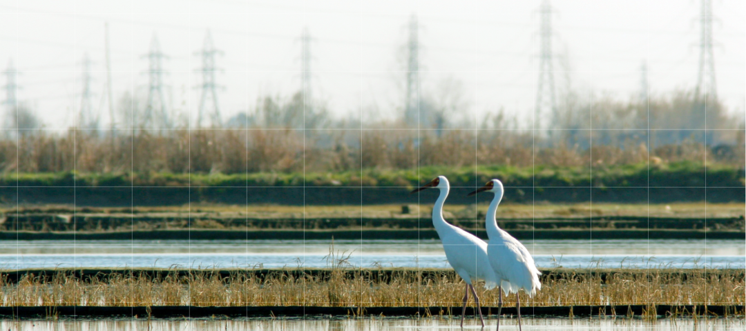
As the need for alternative energy sources grows worldwide, it is imperative that many developed and developing countries significantly increase their development of renewable energy infrastructure. However, radically increasing renewable energy infrastructure could negatively impact highly sensitive endangered or threatened bird species and their habitats if not planned correctly.
AviStep, the avian sensitivity tool for energy planning, was envisioned by BirdLife International as a mapping tool that can aid funders, government agencies, and regional planners in identifying key areas where renewable energy development could negatively impact sensitive bird species and habitats.
DVG partnered with BirdLife International to design and develop AviStep as a cloud hosted application that leverages the latest in Microsoft Azure’s cloud platform and Esri’s mapping technology. The application allows users to select specific countries or regions within southeast Asia and view avian sensitivity maps within those locales for different types of renewable energy infrastructure, including powerlines, onshore wind, offshore wind and solar.
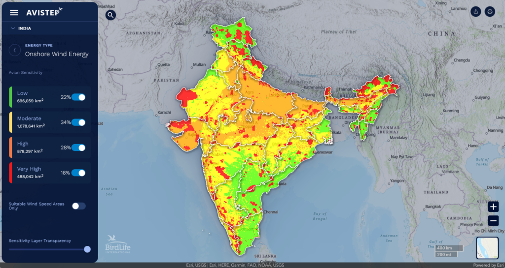
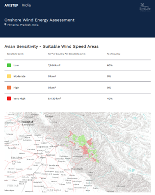
Utilizing the latest ArcGIS Maps SDK for JavaScript, the AviStep application is built to render BirdLife’s avian sensitivity metrics and maps data from ArcGIS Online, including information on sensitive sites, habitats, landcover sensitivity and sensitive species. Users can also drill down to specific regions or cells and print on the fly PDF reports on sensitivity metrics for a specific location. Using user-centric design principles and an agile approach, DVG worked closely with BirdLife International to bring their ideas to life and ultimately design an application that was both engaging and informative.
The tool was principally built with scalability and maintainability in mind. The application architecture and use of Esri’s cloud mapping platform (ArcGIS Online) allows for BirdLife International’s team to easily add sensitivity maps and coverage areas for additional countries and regions in the future as needed.
For more information on the tool and to view the full AviStep application, please visit avistep.birdlife.org