
Tackling the climate emergency requires a rapid, worldwide transition to renewable energy technologies. However, such a comprehensive reshaping of our global energy infrastructure will pose significant threats to biodiversity if not planned responsibly. To address this, BirdLife International has developed AVISTEP – the Avian Sensitivity Tool for Energy Planning to identify where renewable energy could impact birds and should therefore be avoided.
Assignment
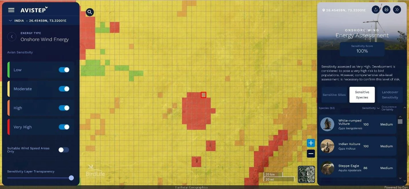
AVISTEP was envisioned and supported by BirdLife International, a U.K. based nonprofit organization and global partnership of NGOs and national conservation organizations that share a common goal – to mobilize lasting, sustainable protection for the world’s birds, their habitats, and global biodiversity in general. DVG helped BLI achieve this goal by building a web mapping application using Esri Technology called AVISTEP – the Avian Sensitivity Tool for Energy Planning. The application uses a map-based interface to identify where renewable energy could impact birds and should therefore be avoided.
Approach
DVG followed user-centric design principles to understand the people who were going to use the application, and what specifically they were going to use it for. Using this information, DVG defined the objectives and tasks that the users needed to accomplish and created a detailed requirements backlog. DVG created design prototypes and worked collaboratively with the customer to evaluate and refine the prototypes until the final solution was created.
Results
DVG partnered with Birdlife International to develop AVISTEP, a cloud-hosted application that uses a map-based interface to identify areas where renewable energy could impact bird species in Southeast Asia. Equipped with this information, those involved in planning renewable energy will be able to develop conscientiously, ensuring minimal impact to sensitive avian species.
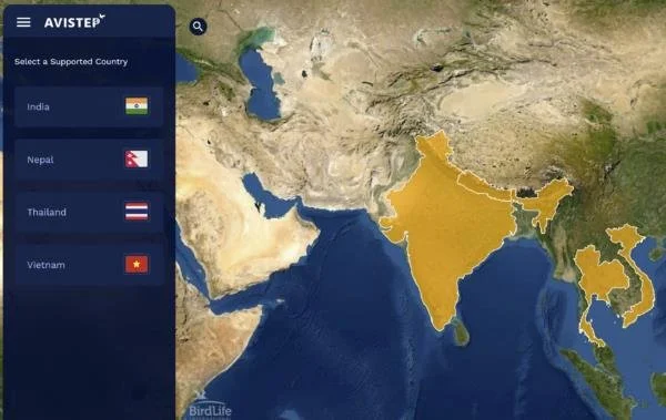
AVISTEP can be used to analyze areas of India, Nepal, Thailand, and Vietnam.
AVISTEP is cloud-hosted using Microsoft Azure and Esri ArcGIS Online, both global leaders in cloud technology and geographic information systems.
AVISTEP enables users to evaluate avian sensitivity to multiple energy development types: Wind Energy, Solar Photovoltaic, Distribution Powerlines, and Transmission Powerlines.
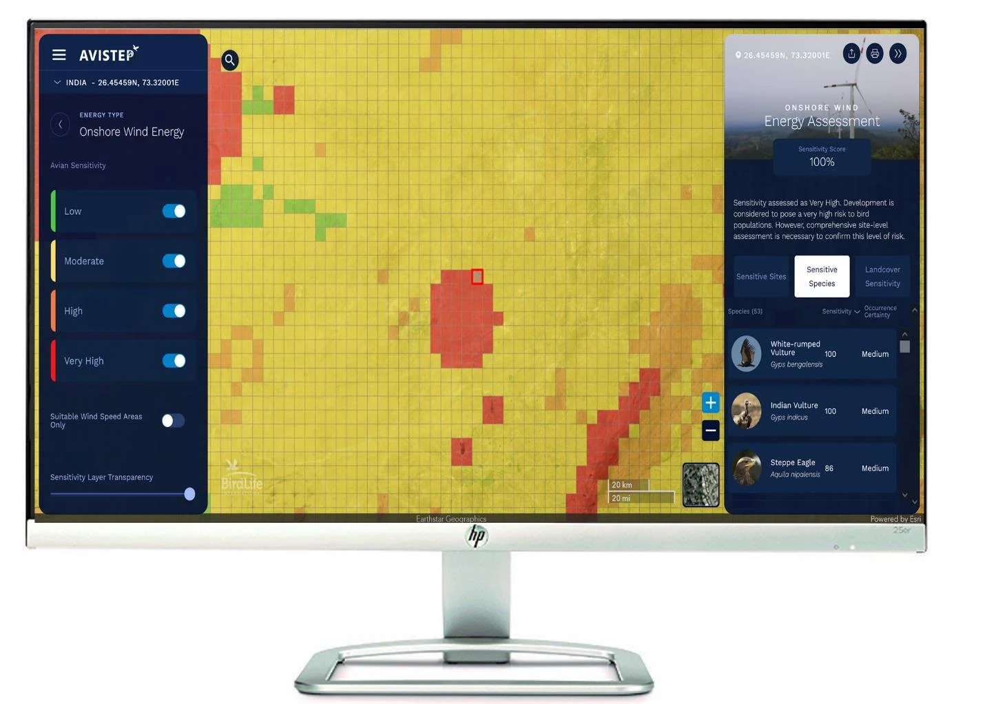
Avian sensitivity metrics include sensitive sites, sensitive species, and landcover sensitivity.
AVISTEP covers India, Nepal, Thailand, and Vietnam.
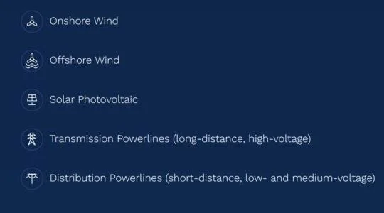
AVISTEP provides users with spatial heat maps depicting potential avian sensitivity in relation to the these types of energy infrastructure.
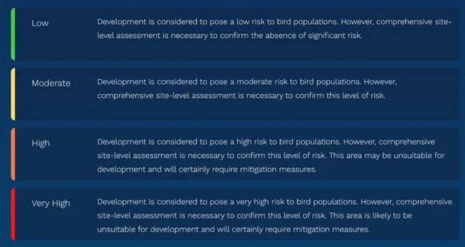
Each 5km x 5km cell within the heatmaps has a sensitivity score. These scores have been grouped into four categories of sensitivity represented by the these colors.
Powered by ESRI
As a proud partner of Esri, DVG integrated its powerful mapping GIS capabilities into this application with great success for the customer.