Enhancing and Automating a Work Order System
To enhance and add efficiency to the existing implementation of ArcGIS Workforce at Lower Township Municipal Utility Authority (LTMUA) by creating automated processes that will save LTMUA staff time and effort. The LTMUA had been successfully using ArcGIS Workforce to manage their field team, and they wanted it to serve as the primary work order system that contained new and historical work orders. DVG was tasked with adding increased functionality in Workforce for dispatchers to easily view work order history, automate recurring work orders, and to safeguard crucial information with regular data backups.
Assignment
To enhance and add efficiency to the existing implementation of ArcGIS Workforce at Lower Township Municipal Utility Authority (LTMUA) by creating automated processes that will save LTMUA staff time and effort. The LTMUA had been successfully using ArcGIS Workforce to manage their field team, and they wanted it to serve as the primary work order system that contained new and historical work orders. DVG was tasked with adding increased functionality in Workforce for dispatchers to easily view work order history, automate recurring work orders, and to safeguard crucial information with regular data backups.
Approach
The goal of this project was to add efficiency to the LTMUA work order system by creating automated processes that would save LTMUA staff time and effort. We took a COTS first approach in designing the solution, leveraging technologies that the LTMUA already owns and has experience with, specifically ArcGIS Online and Workforce. We worked closely with the LTMUA team
Results
The project resulted in a solution comprised of several deliverables, each helping to enhance and automate the LTMUA’s Work Order System:
An ETL (Extract-Transform-Load) script was developed to load the historical work orders for assets into ArcGIS Workforce so that historical work orders can be viewed by selecting an asset.
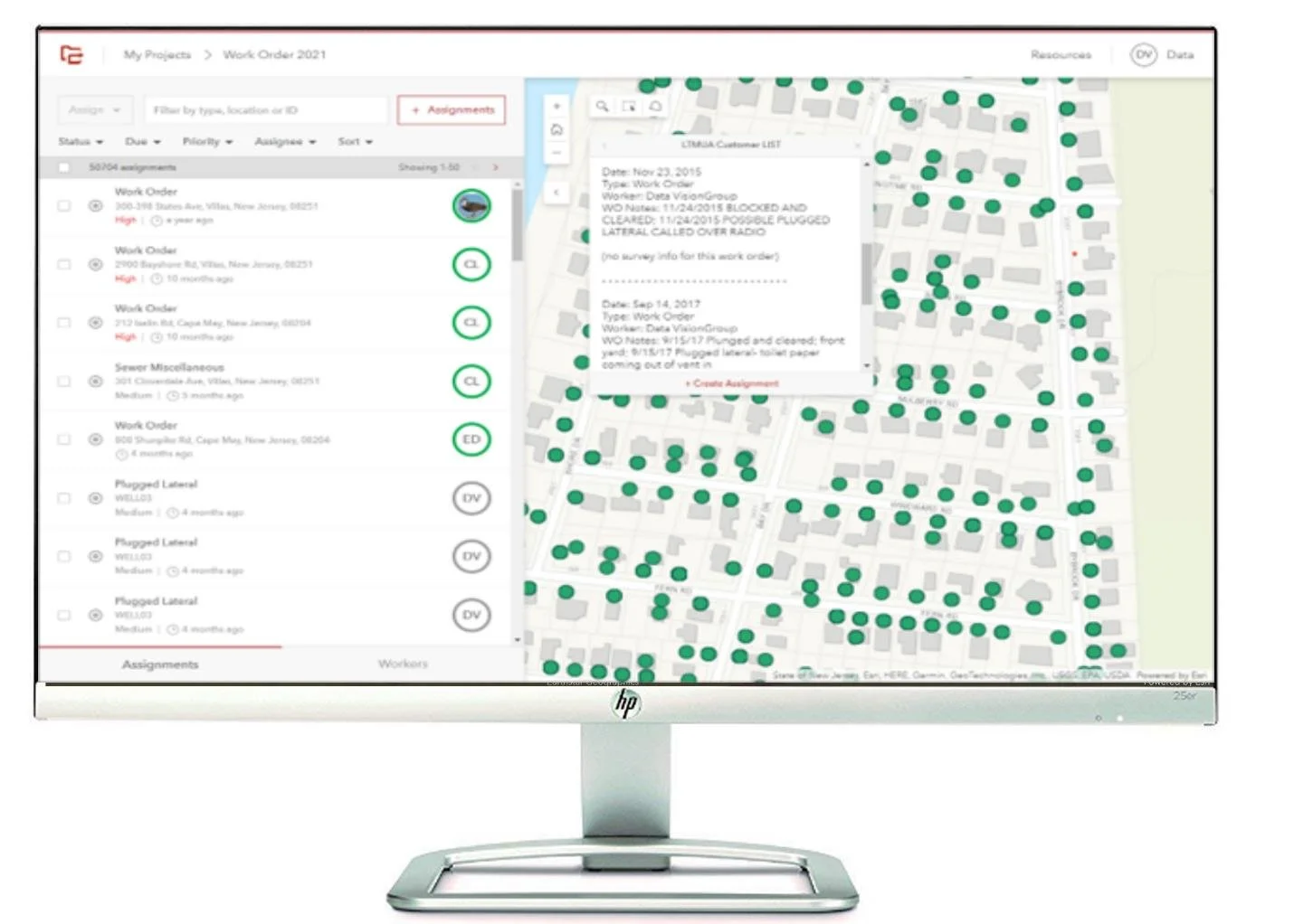
The ArcGIS Workforce Dispatcher map was enhanced to display a complete work order history for each asset, along with Survey123-collected data with one click on the map.
A map-based Work Order Scheduling application was built using ArcGIS Web AppBuilder to enable dispatchers to automate the scheduling of recurring assignments.
An automated data backup and recovery system for ArcGIS Online hosted layers was built using Azure serverless automation and storage accounts.
An ArcGIS
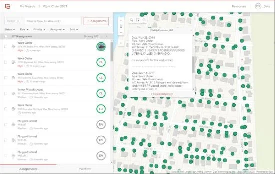
Enhanced ArcGIS Workforce Dispatcher
DVG enhanced the LTMUA’s existing ArcGIS Workforce project Dispatcher map to provide historical work order and survey information to the dispatcher using a custom attribute display pop-ups that includes information from previous Workforce assignments at each of these locations, as well as data from the Survey123 forms conducted as part of the assignment.
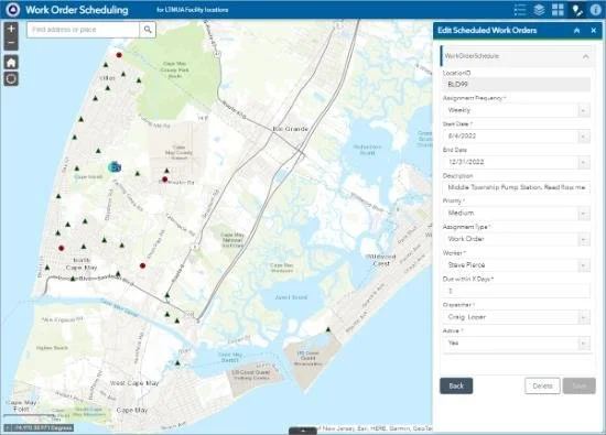
Work Order Scheduling Application
DVG designed and built an automated work order scheduling system to eliminate the need to manually schedule work orders for recurring work orders. We used ArcGIS Web AppBuilder to create an application for maintaining recurring work order schedules and Azure Logic Apps to read the work order schedule and create a Workforce assignment for any work orders scheduled to occur.
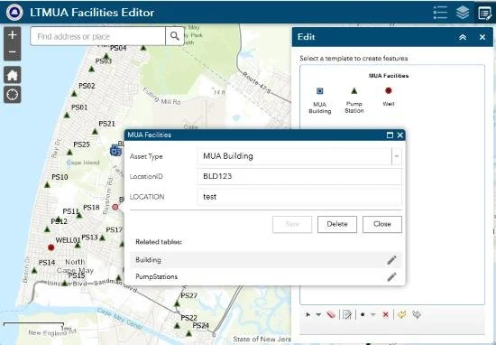
LTMUA Facilities Editor Application
DVG developed a map-based application using ArcGIS Web AppBuilder for LTMUA GIS Administrators to maintain the newly created LTMUA Facilities point layer and its related tables. This web application enables the LTMUA GIS Administrator to update the LTMUA Facilities data in a visual interface with an easy-to-use editing panel and also preserves the integral relationship fields.
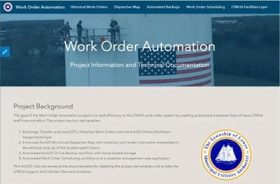
Project Documentation HUB Site
DVG built an ArcGIS Hub site to serve as the end-user guide and an administrator portal for an LTMUA Work Order Automation project. While traditionally used for community engagement, ArcGIS Hub technology is perfectly suited for this purpose. The site was developed in the LTMUA’s ArcGIS Online organization along with the other project deliverables, so hosting the user guide in a Hub site in the same AGO organization made it a seamless and efficient way to integrate the user guide with dynamic content.
Powered by ESRI
As proud partner of Esri, DVG integrated their powerful mapping GIS capabilities into this application with great success for the customer.